SHARE THIS PAGE
Drone flight geography calculator
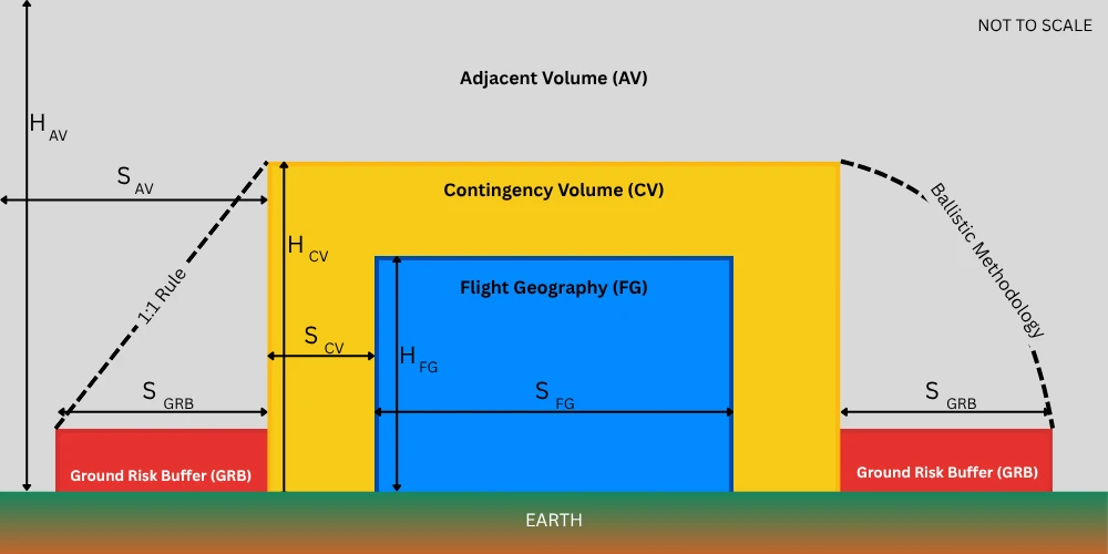
Calculator based on SORA methodology for defining Flight Geography, Contingency Volume and Ground Risk Buffer as described in this guide published by the Luftfahrt-Bundesamt (LBA). Download the methodology doc. for this calculator.
Calculations are dynamic and all entries are auto-saved across sessions.
Visualization only available on larger screens
This content was printed 26-Jul-26 02:54 and is Copyright 2026 Dronedesk.
All rights reserved.
Top
All rights reserved.